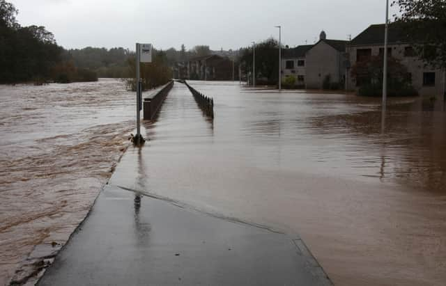
New flood warnings for parts of Angus as yellow weather alert to stay in place until Sunday


Warnings have been issued for Brechin, Finavon and Tannadice, and the Bridge of Dun area and alerts are also in place for larger parts of Angus, Dundee, and Perthshire.
Flood warnings are the second highest level issued by Sepa meaning flooding is expected. River levels were predicted to rise overnight on Thursday and remain high over the weekend.
Advertisement
Hide AdAdvertisement
Hide AdParts of the county are forecast to receive up to 150mm of rain over the next four days.
It follows another yellow warning issued by the Met Office covering noon on Thursday until noon on Sunday.
In a statement, Sepa said: “The latest forecast from the Met Office is predicting prolonged periods of heavy rain in the north east around the South Esk.
“This has the potential to result in surface water and river flooding in the same areas as last week, though rivers are not expected to reach the same levels.
Advertisement
Hide AdAdvertisement
Hide AdThe warning added: “Residual impacts from Storm Babet may mean riverside areas will flood again, including in Brechin.”
Angus Council is again urging drivers to consider whether their journeys over the weekend are absolutely necessary.
A spokesperson said: “When providing updates on roads closures in Angus due to Storm Babet, we emphasise this does not provide the full picture.
“Many roads may become flooded but not yet marked as being closed. If you find that a road is flooded, turn around and find another route.
Advertisement
Hide AdAdvertisement
Hide Ad“Do not ignore Road Closed signs. Signs will be removed when a road can be safely re-opened.
“The public should stay away from swollen rivers and not walk or drive through flood water. Just an egg-cupful of water sucked into a car's engine will lead to severe damage.
“Although water may seem shallow, just 30cm of moving water can float a car, potentially taking it into even more dangerous deeper water. Flood water also contains hidden hazards which can damage your car.
“When faced with flood water, don’t drive through it. Turn around.”
Advertisement
Hide AdAdvertisement
Hide AdAngus Council’s severe weather watch page remains open and contains important updates and information. Help and advice for people and businesses affected by severe flooding is also provided through the local authority’s flood recovery support page.
Rail operator Scotrail is also advising travellers that there will be disruption to services between the Central Belt and Aberdeen and Inverness. As a result, customers travelling between these areas will need to change at Perth (for travel to Inverness) and Dundee (for travel to Aberdeen) as there will be no direct ScotRail services from the start of service on until Sunday.
The train operator will operate more localised shuttle services to help keep customers moving. This will see services operating between Aberdeen and Dundee, and between Inverness and Perth.
Speed restrictions will be in place as a safety precaution, which means services may be subject to delay or cancellation. This is because heavy rainfall is forecast in areas which already have high water levels and saturated ground after Storm Babet.
Advertisement
Hide AdAdvertisement
Hide AdCustomers are advised that journeys in the affected areas will take longer than usual, and to check their journey before travelling. Live updates will be available on the ScotRail website, mobile app, and social media channels.
David Simpson, ScotRail Service Delivery Director, said: “The Met Office has issued a yellow weather warning for heavy rain across the Highlands and northeast of Scotland until Sunday.
“Our first priority is always to ensure the safety of our staff and customers.
“As a precautionary measure, speed restrictions will be in place across the Highlands and northeast, which will result in extended journey times and the removal of some direct services.
“We ask customers to keep an eye on our website, app, or social media feeds for live updates.”