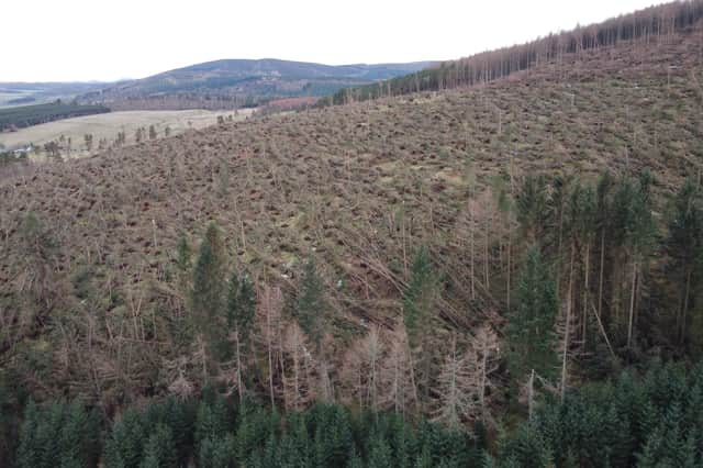
Over-flights of forests help to prepare recovery operation


With drones proving to be of limited use, aircraft were deployed to over-fly the most badly affected forests in the region, and Aberdeenshire – a dispersed area of 29,000 ha, which if all in one place would be four and a half times the size of Dundee.
The information gathered indicates that within the area surveyed, 2600 ha of forest has been felled by the storms. The hundreds of thousands of trees that need to be cleared amount to around 1,000,000 cubic metres of timber, the equivalent of two years of planned felling operations.
Advertisement
Hide AdAdvertisement
Hide AdNick Gough, FLS’s planning projects manager, said that while the scale of the damage has been generally understood for some time, the challenging logistical task of clearing up required gathering a significant amount and degree of detailed data.
He continued: “Ground-based surveys and initial drone flights, that provided standard panoramic pictures, helped us identify areas where we needed more detail. But with drones limited in their capability by things such as wind speed, battery life and the need to maintaining line of sight, it made sense that we opt for aircraft imaging.
“Thanks to a spell of good weather we were fortunate to complete our entire survey programme in a little over a week.
"This then gave us the data we needed to build up digital photo-mosaics that gave us the high quality information that we have now put directly in to our mapping software."
Advertisement
Hide AdAdvertisement
Hide AdFLS worked with Caledonian Air Surveys, one of only two companies in Scotland capable of delivering what was required.
The aerial images have now been processed by FLS’s specialists who have mapped the areas of windblow and analysed the data to identify work areas, likely timber volumes and the logistics of recovering, storing and uplifting the storm-felled timber.
The data will also help to prioritise timber recovery work according to the species of tree and the different rates at which the fallen timber will begin to degrade. Clear-up work at some less severely damaged forests has been under way for some time.